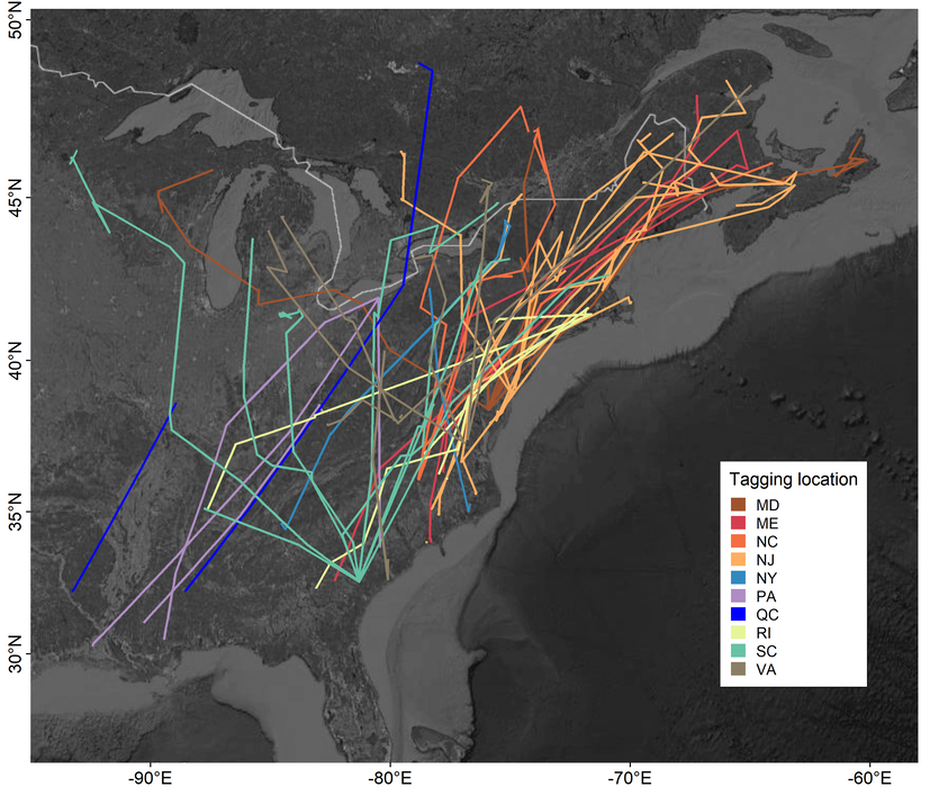
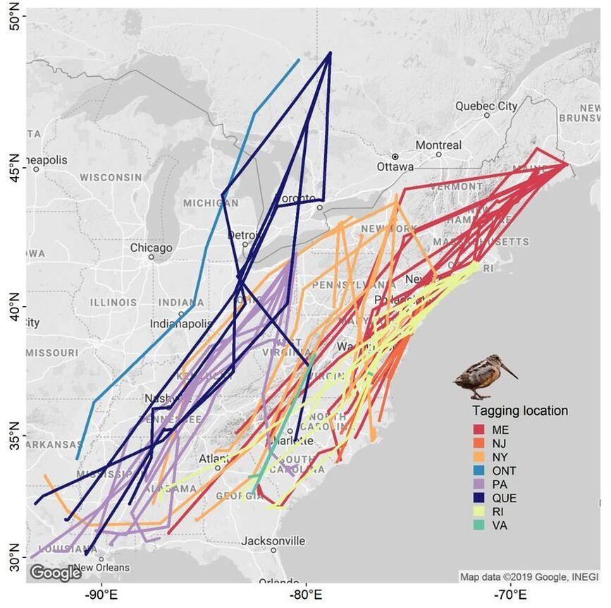
This map depicts migration paths of our GPS-tagged American Woodcock as they made their way from wintering areas northward during spring migration. The map includes data from birds marked during September and October 2018 at northern breeding areas, as well as birds marked during winter 2018/19 in southern wintering sites. These data will allow us to characterize important migration routes and stopover sites throughout eastern North America.
This map depicts the migration paths of our satellite-tagged American Woodcock during their fall migrations of 2017 and 2018, color-coded to the state or province in which they were marked. This highlights the significant variation in migration paths taken by individual woodcock captured in the same location. All data were collected during September-December in either 2017 or 2018, and the stopover locations of birds we followed during 2018 are showed below. Map created by Erin Pickett.
Copyright © 2024 Eastern Woodcock Migration Research Cooperative.
All Rights Reserved.
All Rights Reserved.

